History:
Joyce Kilmer–Slickrock was designated a
wilderness area by the 1975 Wilderness Act. In 1984, the original 14,033
acres increased to the present 17,013 acres. Joyce Kilmer–Slickrock
shares a common boundary along the Unicoi Mountains with the Citico
Creek Wilderness in the Cherokee National Forest in Tennessee. Part
of the Joyce Kilmer–Slickrock Wilderness Area are actually in
the Cherokee National Forest, although the majority of its lands are
in the Nantahala National Forest in North Carolina.
Much of the surrounding land in the region was
logged by timber companies. Babcock Land and Timber Company, which logged
the surrounding Slickrock Creek area, owned the Little Santeetlah Creek
basin that forms the Joyce Kilmer Memorial Forest. Throughout the years,
other timber companies owned the land, yet they never logged it. By
chance the forest in the Little Santeetlah basin had been spared. Many
odd circumstances contributed to its survival, such as the construction
of two lakes—Calderwood and Santeetlah—that flooded the
rail system used for transporting the timber out of the region and the
bankruptcy of a logging company just before it was ready to use its
recently constructed splash dams to float out the trees. Finally, the
U.S. Forest Service purchased 13,055 acres in the Little Santeetlah
basin from Gennett Lumber Company in 1935 for $28 an acre—an exorbitant
price at a time when most land was selling for only $4 an acre. But
it was worth it, and the Joyce Kilmer Memorial Forest was dedicated
on July 30, 1936, 18 years to the day after the poet's death. In 1975,
Congress designated the Joyce Kilmer–Slickrock Wilderness, which
included the memorial forest.
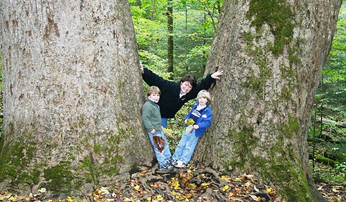
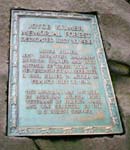
Joyce Kilmer Memorial Forest is the
highlight of this wilderness area. The 3,840-acre preserve was named after
the poet Alfred Joyce Kilmer, who wrote the poem "Trees," although
Kilmer never saw the virgin poplar and hemlocks here that have graced
the earth for 400 years, some reaching 150 feet in height and 20 feet
in circumference.
To Joyce Kilmer Memorial Forest: take US 129
north approximately 1 mile past Robbinsville. Turn left onto NC 143
west (marked with a sign for Joyce Kilmer). After approximately 3.5
miles, turn left onto SR 1127 and continue for approximately 9 miles.
The entrance is well marked on the left. To access the wilderness's
southern perimeter, start at the Cheoah Ranger Station and turn left
onto SR 1116. Travel 2.4 miles and turn right onto SR 1127. Continue
for 6.9 miles to an unmarked road; turn left and then turn immediately
right onto FR 81 (gravel road). Travel 6.8 miles to FR 81F and turn
right at the forest service sign. Wolf Laurel Hunter Camp is ahead 4.4
miles on the left, and the parking area, signboard, and trailhead for
Wolf Laurel Trail another .5 mile. To enter the northern portion of
the wilderness, travel on US 129 for 5.6 miles north of where it intersects
Old US 129. At a bridge across the Cheoah River, turn left onto a narrow,
gravel road, FR 62. Continue for 7.2 miles to a parking area and the
trailhead for Big Fat Gap Trail.
The two dominant watersheds in the
wilderness area are the Little Santeetlah Creek and Slickrock Creek, which
are joined by a common ridgeline at their head-waters. The elevations
ranging from 1,086 feet at the mouth of Slickrock Creek to 5,341 feet
on Stratton Bald. Rock outcrops are common, and a network of streams dissect
the terrain.
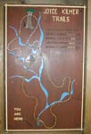
The trail network within the entire
Slickrock Wilderness Area offers more than 60 miles of trails carefully
laid out to allow access to the many topographic regions within the wilderness,
such as rock outcrops; rich, moist coves; virgin and old- growth forests;
boulder-strewn creeks; and grass and heath balds. The trails also were
designed to interconnect and, therefore, allow extended hikes through
the wilderness. Because this is a wilderness area, with the exception
of the paths at Joyce Kilmer Memorial Forest, the trails are primitive,
rugged, and virtually unmarked. Some are easy to follow or are used enough
to make the pathway obvious. Others, however, are more difficult, and
like any wilderness experience, they require a topographic map and compass.
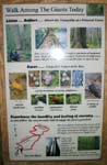
Wilderness areas are often associated
with serenity and solitude. As interest in this area grows, however, some
trails and sections are more popular than others. According to the Joyce
Kilmer–Slickrock map from the U.S. Forest Service, the trails within
the wilderness that offer the least opportunity for solitude include Joyce
Kilmer National Recreation Trail, Naked Ground, Big Fat Gap, Hanover Lead,
Slickrock Creek Stiffknee Trail, and Falls Branch Falls Trail. Stratton
Bald, on the other hand, offers a journey into virgin forest on a quiet
and peaceful trail. The trailhead is found easily just across the Santeetlah
Creek from the Rattler Ford Group Campground near Joyce Kilmer. Though
it is rated "most difficult," other than a few rocky segments,
it is a moderate, easy trail into a pristine virgin forest.
Just outside the wilderness area in
the Nantahala National Forest,
Maple Springs Observation Area offers a spectacular 180-degree view of
the surrounding mountains. An easy 5-mile drive north of Joyce Kilmer
on SR 1127, this is literally a road to nowhere. It began as part of the
road first envisioned in the 1950s that today is known as Cherohala Highway.
Construction began in 1965, but when the area was designated as wilderness,
the road had to be rerouted along the Unicoi Crest. As a result, this
earlier road now ends at the Maple Springs parking area; en route to its
end, it also serves as access to the Haoe Lead Trail
From the parking area, a wooden deck
leads to a magnificent view of the surrounding mountains including the
Snowbird, Great Smoky, Unicoi, and Cheoah ranges.The Observation deck
is handicapped accessible and offers easy access to this rewarding vista.
On a sunny day, Santeetlah Lake glistens in the valley to the right, and
the abundant mountain laurel explodes with pink and white blossoms in
early June.
Wildlife:At an elevation of 3,520 feet, the overlook affords
opportunities to watch from above the aerial aerobics of a variety of
summer birds such as the broad-winged and red-tailed hawk (Buteo platypterus
and B. jamaicensis), cedar waxwing (Bombycilla cedrorum), great crested
flycatcher (Myiarchus crinitus), American goldfinch (Spinus tristis),
indigo bunting (Passerina cyanea), pileated woodpecker (Dryocopus pileatus),
downy woodpecker, scarlet tanager, and numerous warblers.
Flora for Fauna: A variety of violets, trilliums , solomon's seal , galax , crested dwarf
iris , jack-in-the-pulpit , and carpets of ferns.
In addition to the mighty yellow-poplar
and Eastern hemlock, the forest has red oak , basswood , red maple , American
beech , yellow birch , Carolina silverbell, dogwood , and witch-hazel
, among others. Birds are hard to spot in these tall treetops, but the
songs of the downy woodpecker , wood thrush , solitary and red-eyed vireo,
ovenbird , golden-crowned kinglet, scarlet tanager , and brown creeper
have been reported.
Primitive camping sites are abundant throughout
the wilderness area, and U.S. forest campgrounds are near the boundary.
In addition, the U.S. Forest Service Horse Cove Campground Area offers
17 units adjacent to the rushing mountain stream, Little Santeetlah
Creek. The campground is located directly across from the entrance to
Joyce Kilmer picnic area. Fishing is popular along and in the Little
Santeetlah Creek and Slickrock Creek, as well as at nearby Santeetlah
Lake.