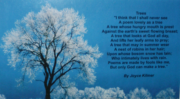
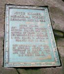
Joyce Kilmer Memorial Forest is the
highlight of this wilderness area. The 3,840-acre preserve was named after
the poet Alfred Joyce Kilmer, who wrote the poem "Trees," although
Kilmer never saw the virgin poplar and hemlocks here that have graced
the earth for 400 years, some reaching 150 feet in height and 20 feet
in circumference.
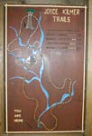
To Joyce Kilmer Memorial Forest: take US 129
north approximately 1 mile past Robbinsville. Turn left onto NC 143
west (marked with a sign for Joyce Kilmer). After approximately 3.5
miles, turn left onto SR 1127 and continue for approximately 9 miles.
The entrance is well marked on the left. To access the wilderness's
southern perimeter, start at the Cheoah Ranger Station and turn left
onto SR 1116. Travel 2.4 miles and turn right onto SR 1127. Continue
for 6.9 miles to an unmarked road; turn left and then turn immediately
right onto FR 81 (gravel road). Travel 6.8 miles to FR 81F and turn
right at the forest service sign. Wolf Laurel Hunter Camp is ahead 4.4
miles on the left, and the parking area, signboard, and trailhead for
Wolf Laurel Trail another .5 mile. To enter the northern portion of
the wilderness, travel on US 129 for 5.6 miles north of where it intersects
Old US 129. At a bridge across the Cheoah River, turn left onto a narrow,
gravel road, FR 62. Continue for 7.2 miles to a parking area and the
trailhead for Big Fat Gap Trail.
Activities:Hiking, picnicking.
Facilities:Parking, picnic tables and grills, restrooms, water.
Primitive camping sites are abundant throughout
the wilderness area, and U.S. forest campgrounds are near the boundary.
In addition, the U.S. Forest Service Horse Cove Campground Area offers
17 units adjacent to the rushing mountain stream, Little Santeetlah
Creek. The campground is located directly across from the entrance to
Joyce Kilmer picnic area. Fishing is popular along and in the Little
Santeetlah Creek and Slickrock Creek, as well as at nearby Santeetlah
Lake.
Fees:Charge for camping
Closest town:Robbinsville, 17 miles.
For more information: Cheoah Ranger Station,
Route 1, Box 16A,
Robbinsville, NC 28771.
Phone (704) 479-6431.
Tim Homan's Hiking Trails of Joyce Kilmer–Slickrock and Citico
Creek Wilderness Areas.