Explore Blue Ridge Mountains

Trails in North Carolina & Georgia

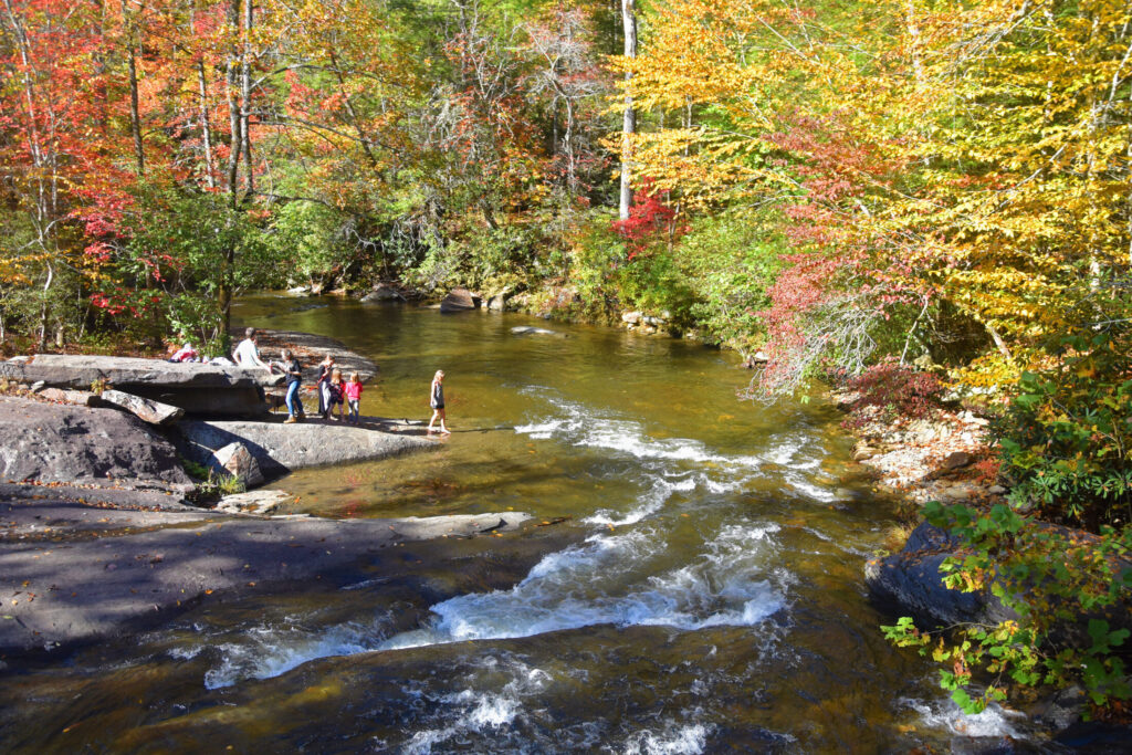
Reconnect with the beauty of nature by hiking the scenic and panoramic trails of the Blue Ridge Mountains!

There is no dull moment when you start exploring the trails of the breathtaking Blue Ridge Mountains because as you go higher, the better the reward: a picturesque view from above, a sky painted with majestic blue hues, and cool fresh air from the lush green plants and towering trees!

Here are some of the best hiking trails in the Blue Ridge Mountains. Experience a breathtaking moment with nature and bring your friends or family with you for a more memorable time!

dried leaves and trees around a small river
Credit: Photo by Gary Ward | Source
Hanging Dog Recreation Area, off NC 1338, Murphy, NC 28906

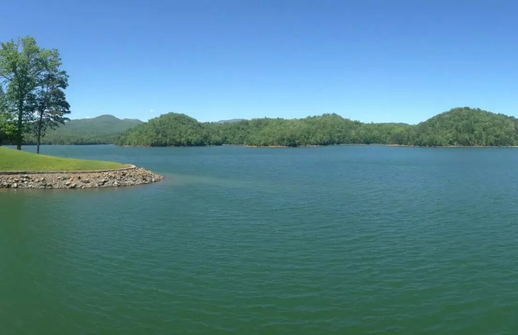
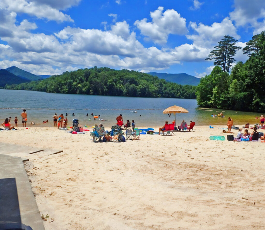
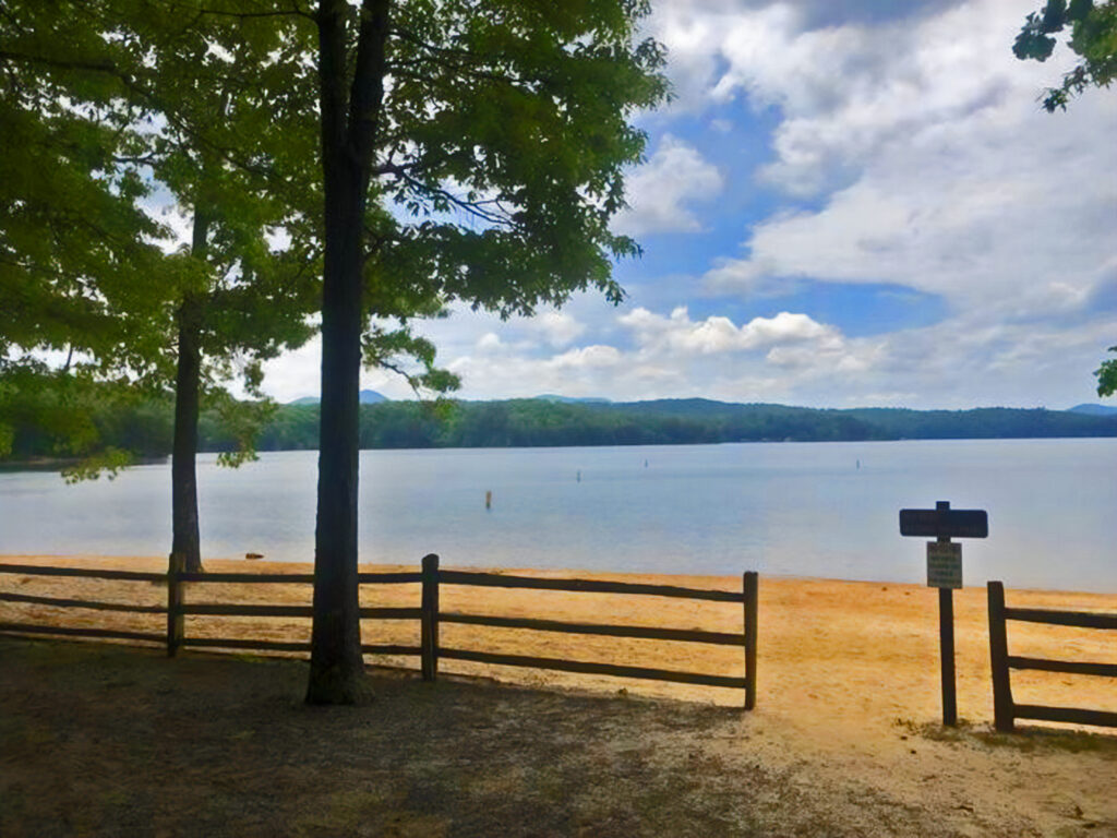
Are you ready to chase literal high rewards? Then, hit the Piney Knob Trail and be astounded at what awaits you at the top: breathtaking LakeHiwassee views.

a wooden bridge on a lake surrounded by trees
Credit: Photo by Gary Ward | Source
Konehete Park, 250 Konehete St, Murphy, NC 28906

If you’re looking for a chill hiking or biking trail, try Murphy River Walk. It’s a beginner-friendly trail measuring for 4 miles of easy paved loop.

Lake Hiwassee in Murphy NC
Credit: Photo by Gary Ward | Source
Hiwassee Dam Access Rd, Murphy, NC 28906
  • Length & Difficulty: 2.5 miles round-trip, moderate.
  • Notable Features: Dam overlook, lake views, historical site
Credit: Photo by Gary Ward | Source
Tatham Gap Road, off NC 141, Andrews, NC 28901

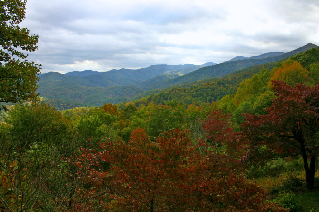
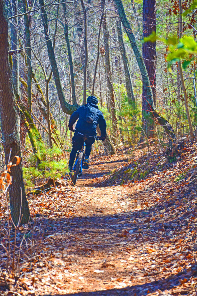
Increasing the difficulty by a level, Tatham Gap Trail is a moderate-strenuous trail that should not be underestimated. It is an 8-mile one-way trail offering striking views of rolling hills and historic paths. Your biking skill will be tested on this one!

a falls surrounded by trees in Snowbird Mountain
Credit: Photo by Gary Ward | Source
Snowbird Picnic Area, off NC 1110, Robbinsville, NC 28771
  • Length & Difficulty: 6 miles round-trip, moderate.
  • Notable Features: Panoramic views, wildflowers, creek access.
a view from the summit of a mountain
Credit: Photo by Gary Ward | Source
Near Snowbird Creek, off NC 1110, Andrews, NC 28901
  • Length & Difficulty: 3.6 miles round-trip, moderate.
  • Notable Features: Summit views (4,409 ft), forested path, less traveled.
Leaf-covered dirt trail winding through a dense, green forest.
Credit: Photo by Nicole Densmoor on Unsplash | Source
John C. Campbell Folk School, 1 Folk School Rd, Brasstown, NC 28902
  • Length & Difficulty: ~1-2 miles total, easy (multiple short loops).
  • Notable Features: Bark-chipped paths, Cherokee heritage sculptures (Rivercane Walk), creek views, peaceful campus setting.
a person looking at the mountain views in Brasstown Bald Visitor Center
Credit: Photo by Gary Ward | Source
Brasstown Bald Visitor Center, 2941 GA-180 Spur, Hiawassee, GA 30546
  • Length & Difficulty: 5.6 miles one-way, strenuous.
  • Notable Features: Steep climb to 4,784 ft, 360-degree views, wildflowers.
a man riding a mountain bike in the river
Credit: Photo by Gary Ward | Source
Jackrabbit Mountain Recreation Area, NC-175, Hayesville, NC 28904

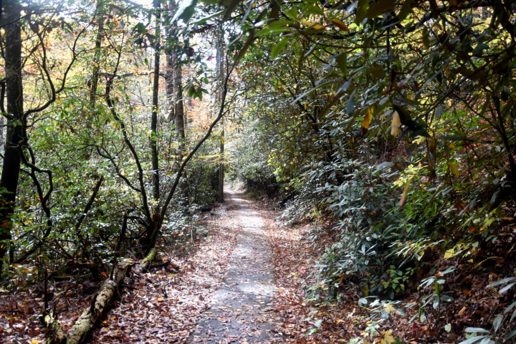
Going back to another easy trail, Jackrabbit Mountain Bike Trail is a must-try. The trail measures 15 miles at an easy to moderate level. Enjoy captivating lake-view vistas in less than 2 hours of biking!

a paved road with the views of Lake Chatuge dam
Credit: Photo by Gary Ward | Source
Clay County Park, NC-175, Hayesville, NC 28904

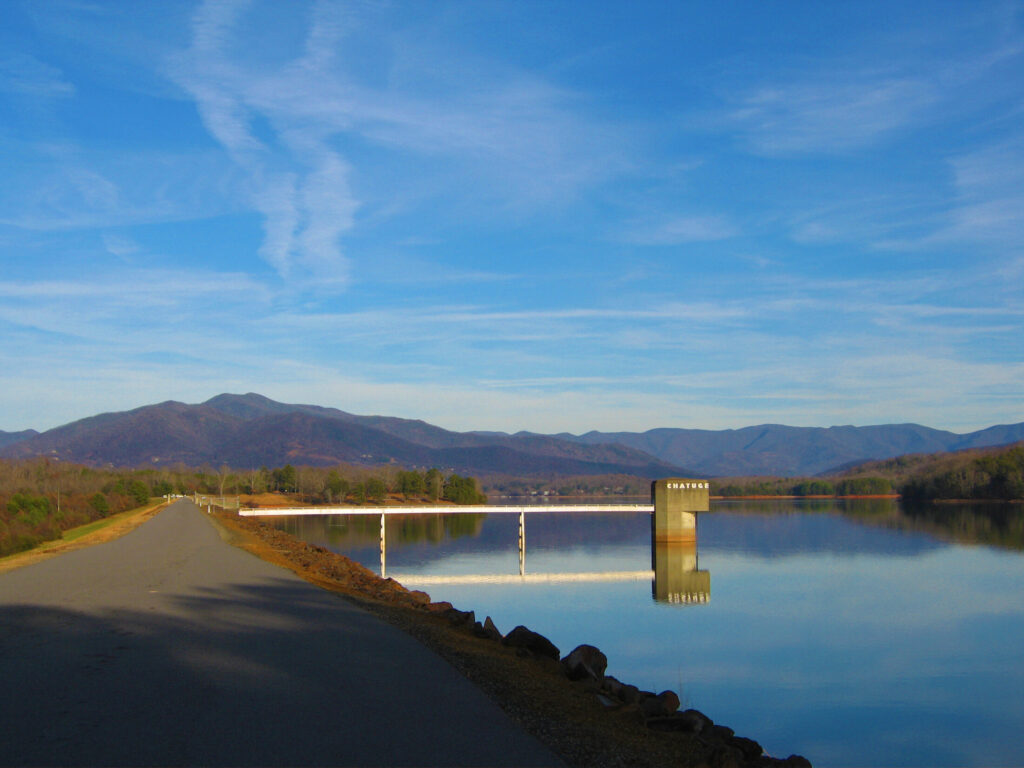
Another quick and easy trail to conquer is the Chatuge Lake Trail, a 3-mile long round-trip trail. It’s ideal for a quick biking or hiking trip and is beginner-friendly!

a group of people near the river
Credit: Photo by Gary Ward | Source
Fires Creek Recreation Area, Fires Creek Road, Hayesville, NC 28904

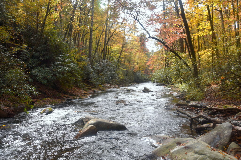
If you love waterfall views and you are ready to conquer the rugged terrain for a sweet reward, you should give Fires Creek Loop a try. It’s a 6-mile round-trip trail with a rating of moderate to strenuous. Hike or bike, your choice!

a group of people riding a horse on a trail
Credit: Photo by Gary Ward | Source
US-64 near Clay-Macon line, Hayesville, NC 28904
  • Length & Difficulty: 22 miles one-way, strenuous.
  • Notable Features: Remote ridge, Appalachian Trail link, rugged.
a stairway leading to a shack with views of the lake
Credit: Photo by Gary Ward | Source
Jackrabbit Mountain Recreation Area, NC-175, Hayesville, NC 28904
  • Length & Difficulty: 3.8 miles round-trip, moderate.
  • Notable Features: Lake Chatuge views, forested path, picnic spots.
A cyclist wearing black gear rides a mountain bike along a winding dirt trail covered in fallen leaves at Aska Trails
Credit: Photo by Gary Ward | Source
Aska Rd Trailhead, Aska Road, Blue Ridge, GA 30513

Aska Trails are suitable for a quick challenge for a moderate trail recommendation. The 5-mile round-trip trail offers beautiful rewards, such as striking views of rolling hills and breathtaking mountain views.

A narrow, leaf-covered trail winds through a dense forest at Flat Creek
Credit: Photo by Gary Ward | Source
Deep Gap Trailhead, Aska Road, Blue Ridge, GA 30513

If you can finish a 3-mile loop, you can crush this 5.8-mile loop! Flat Creek Loop is a moderate trail ideal for biking. Its forested singletrack will lead you to challenging creek crossings and enchanting wilderness.

a muddy trail surrounded by trees that leads to a lake
Credit: Photo by Gary Ward | Source
Green Mountain Trailhead, Aska Road, Blue Ridge, GA 30513

The Green Mountain Trail is another moderate trail that challenges your skills with its steep climbs. The trail offers breathtaking Lake Blue Ridge views that are worth capturing.

a view of the Long Creek falls
Credit: Photo by Gary Ward | Source
Three Forks, FS Rd 58, Blue Ridge, GA 30513
  • Length & Difficulty: 2 miles round-trip, easy-moderate.
  • Notable Features: 50-ft waterfall, Appalachian Trail access, forested.
a river surrounded by orange foliage
Credit: Photo by Gary Ward | Source
Springer Mountain, FS Rd 42, Blue Ridge, GA 30513
  • Length & Difficulty: 15 miles one-way, strenuous
  • Notable Features: Scenic ridges, AT connection, remote.
a photo of a hanging bridge over a body of water
Credit: Photo by Gary Ward | Source
Duncan Ridge trail, FS Rd 68, Blue Ridge, GA 30513
  • Length & Difficulty: 3.5 miles round-trip, moderate.
  • Notable Features: 270-ft suspension bridge, river views, fishing.
a view of Vogel State Park Lake with a deck and surrounded by trees
Credit: Photo by Gary Ward | Source
Vogel State Park, 405 Vogel State Park Rd, Blairsville, GA 30512
  • Length & Difficulty: 4.1-mile loop, moderate.
  • Notable Features: Lake Trahlyta views, 1,000-ft gain, forested.
a view of a rocky falls
Credit: Photo by Gary Ward | Source
Helton Creek Rd, Blairsville, GA 30512
  • Length & Difficulty: 0.3-mile round-trip, easy.
  • Notable Features: Two waterfalls (25-ft, 60-ft), short scenic walk.
Credit: Photo by Gary Ward | Source
DeSoto Falls Recreation Area (GA-129, Blairsville, GA 30512
  • Length & Difficulty: 2 miles round-trip, easy-moderate.
  • Notable Features: Two falls (20-ft, 80-ft), gentle path, historic lore.
a photo of a hanging bridge over a body of water
Credit: Photo by Gary Ward | Source
Near Vogel State Park, GA-180, Blairsville, GA 30512
  • Length & Difficulty: 6 miles round-trip, moderate-strenuous.
  • Notable Features: Rugged ridge, mountain vistas, multi-use.
two boys looking at the High Shoals falls on a viewing deck
Credit: Photo by Gary Ward | Source
High Shoals Scenic Area, FS Road 283, Hiawassee, GA 30546

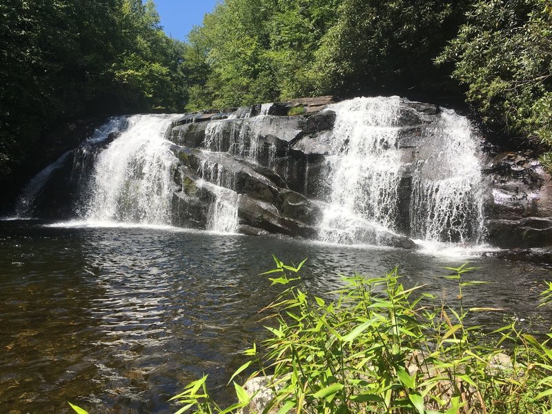
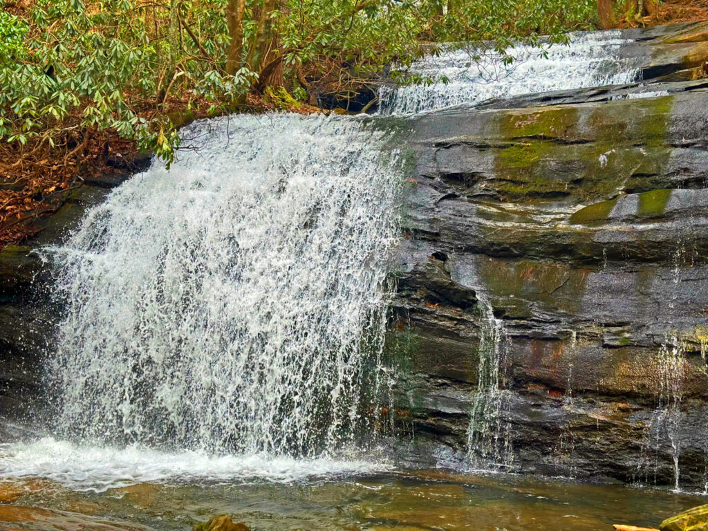
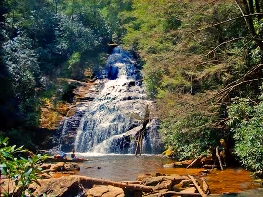
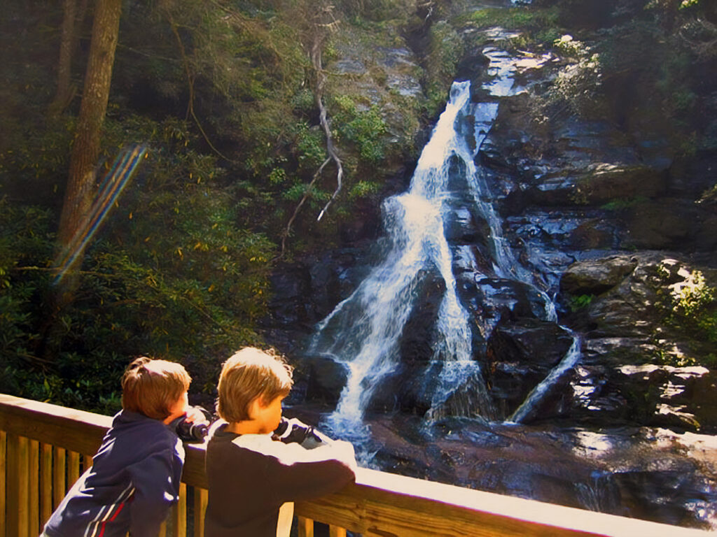
Witness stunning waterfalls on High Shoals Falls Trail, a scenic and peaceful hiking trail for nature lovers. It’s a 2.4-mile moderately difficult trail offering a cascading 120-ft waterfall with a forested descent. Perfect place for Instagram-worthy pictures!

Credit: Photo by Gary Ward | Source
Bell Mountain Park, Hwy 76, Hiawassee, GA 30546
  • Length & Difficulty: 0.5-mile round-trip, easy-steep.
  • Notable Features: Short summit hike, Lake Chatuge views.
a view from the viewing deck of Brasstown Bald Summit
Credit: Photo by Gary Ward | Source
Brasstown Bald Visitor Center, 2941 GA-180 Spur, Hiawassee, GA 30546
  • Length & Difficulty: 1.2 miles round-trip, moderate-steep.
  • Notable Features: 4,784-ft summit, panoramic views.
a group of people basking in the sun near a lake
Credit: Photo by Gary Ward | Source
Towns County Recreational Beach, Hiawassee, GA 30546
  • Length & Difficulty: 3 miles round-trip, easy.
  • Notable Features: Lakeside path, paved sections, beginner-friendly.
a grassy trails surrounded by foliage
Credit: Photo by Gary Ward | Source
Trackrock Rd, Young Harris, GA 30582
  • Length & Difficulty: 6 miles one-way, strenuous.
  • Notable Features: Forested ascent to 4,784 ft, alternative summit route.
a photo of the cupid falls
Credit: Photo by Gary Ward | Source
Near Young Harris College, 1 College St, Young Harris, GA 30582
  • Length & Difficulty: 0.5-mile round-trip, easy.
  • Notable Features: Small waterfall, quick scenic walk, local gem.
scenic views of Lake Blue Ridge and sandy shores
Credit: Photo by Gary Ward | Source
Morganton Point Recreation Area, 475 Lake Dr, Morganton, GA 30560
  • Length & Difficulty: 0.8-mile loop, easy.
  • Notable Features: Lakeside stroll, picnic spots, swimming.
Gary Ward 030223
Take the next step

Ready to take the next step?

Buying property is a huge investment. Having someone who keeps your interest in mind can mean the difference between a good investment and a poor one. Some realtors only look at the bottom line. Gary Ward is an honest family man with strong values, that is why we say to always ask for Gary if you are looking for property in this area or if you are wanting to list your property here. It is the only way we can assure you that you are getting the quality, honesty, and assistance you deserve. Working as a Broker for over 25 years in the north Georgia and North Carolina Mountain area, he will show you any available property and will represent you as a buyer’s agent as long as it is not his listing, in that case he is representing the seller and he will tell you that up front. Either way, you will always know where you stand and be well-informed. His knowledge and expertise in the area will put your mind at ease.

Relocate to Blue Ridge Mountains

Ridge Mountains Trails Interactive Map