Directions:
There are numerous access points. To reach Cheoah
Point Recreation Area, travel on US 129 north from Robbinsville for
5 miles to the junction with SR 1145. Turn left and travel almost 1.5
miles to the campground on the left and the boat ramp ahead.
Activities:
Hiking, camping, fishing, swimming, canoeing,
kayaking.
Facilities:
Boat ramp, swimming beach, campground. Cheoah
Point Campground features 26 sites with picnic tables and grill,
pit toilets, no shower.
Fees:
There is a charge for camping.
Closest
town:
Robbinsville, 7 miles.
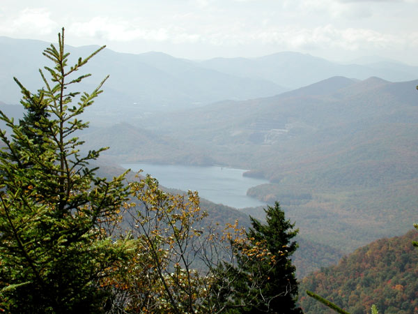
Santeetlah Lake

In the midst of the lush, green mountain slopes, 3,000 acres of open water
ideal for fishing, canoeing, and kayaking comprise Santeetlah Lake. (Its
name is derived from an Indian word meaning "blue waters.")
Santeetlah Lake is formed by the Santeetlah Dam across the Cheoah River
on the northern end of the lake, and, like many of the man-made lakes
in the mountains, Santeetlah makes its way into numerous picturesque coves
and inlets. Most of the shoreline is undeveloped and part of the Nantahala
National Forest, where ample camping opportunities abound. Cheoah
Point, for example, can be reached 6 miles north of Robbinsville off US
129.
Both cold- and warm-water species of fish flourish here, including
largemouth bass, smallmouth bass , walleye, bluegill, brown trout, and
rainbow trout. Reports of osprey and spotted sandpipernear the boating
access area have been recorded in the spring and summer, and great horned
owls have been spotted in the winter. During migration shorebirds and
waterfowl including green herons , prothonotary warblers, and red crossbills
stop by the shallow coves of the many-fingered lake.
Elevation: 1,940 feet.
For
more information:
Graham
County NC Travel and Tourism Authority
PO Box 575
15 North Main Street
Robbinsville, NC 28771
PHONE
1-828-479-3790
1-800-470-3790
EMAIL: info@GrahamCountyTravel.com


