Linville Falls Brevard North Carolina
Relocating to Western North Carolina mountains? Check this Out! Great Carolina Property

Home | Homes For Sale | Farms For Sale | Lakefront Property | Creekfront Properties | Mountain land | Commercial Mountain Real Estate
Our Communities | Working with Advantage Chatuge Realty
Waterfalls of Western North Carolina | Nantahala National Forest | Appalachian hiking trail | Fires Creek wilderness area | Joyce Kilmer Area
Outdoor Recreation in the mountains | Nantahala National Forest | Appalachian hiking trail | Fires Creek wilderness area | Joyce Kilmer Slickrock Wilderness Area
Georgia Waterfalls | Hiking trails of the Georgia Mountains | Georgia State Parks
Hayesville North Carolina | Murphy North Carolina | Hiawassee Ga | Blairsville Ga | Blue Ridge Ga | Young Harris Ga
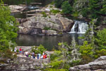
Linville Falls
Directions:
From , North Carolina
the falls are located at Mile Post 316.3 of the Blue Ridge Parkway, north of where US 221 crosses the Parkway and south of where NC 181 crosses the Parkway.
For more information:
Brevard/Transylvania
Chamber of Commerce
35 West Main Street
Brevard, NC 28712
828-883-3700
800-648-4523
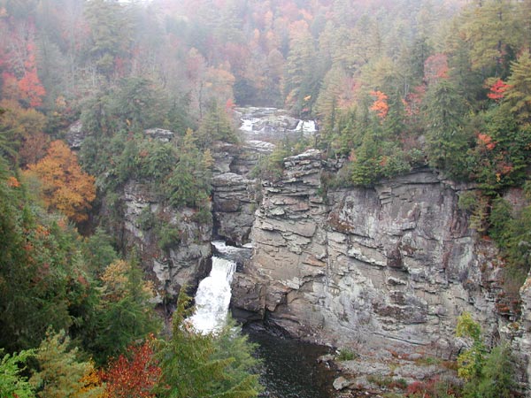
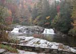
Linville Falls is located on the Blue Ridge Parkway. Trails lead to views of both the upper and lower falls. Forests offer virgin hemlock mixed with other familiar trees such as white pine, oaks, hickory, and birch. A colorful and varied display of wildflowers decorates the trails in the spring. Red and golden leaves in fall beautifully contrast with the soothing green of hemlocks.
Hiking Trails
From the Blue Ridge Parkway, two main hiking trails lead to beautiful
views of the Linville Falls. Both begin at the Linville Falls Visitor
Center, which is operated by the National Park Service. The trails
range in difficulty from moderate to strenuous.
There are short, easy to moderate trails to view the viaduct and falls,
as well as access points to the longer, more strenuous Tanawha
and Mountains to Sea Trails. There are three short
"leg-stretcher" trails in the area, the Beacon Heights
(milepost 305.2), Camp Creek (milepost 315.6), and
River Bend Overlook Trails (milepost 316.4). The
Flat Rock Trail (milepost 308.3) is a moderate self-guiding
trail that explores the flora and fauna of the area. Also located
at Linville Falls is the easy Duggers Creek and Linville
River Bridge Trails.
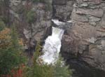
Erwins View Trail, a moderate walk of 1.6 miles round trip, offers hikers four overlooks, each revealing a different aspect of the Linville Falls area. The first overlook is 0.5 mile from the visitor center, and is a moderate walk with a slight loss of elevation. Here, the Linville River spills gently over the upper falls where it widens and pauses. Drifting into a narrow canyon, the water suddenly spirals out of sight and plunges 45 feet over the lower falls. The next overlook, Chimney View, 0.7 mile from the visitor center, is the first point on the trail where the lower falls can be seen. It offers an excellent chance to photograph both the upper and lower falls. The overlook is named for the chimney-like outcroppings located to the right of the waterfall. The trail is strenuous in this area with considerable elevation gain. At Gorge View Overlook, hikers can see the Linville River cutting its way through the Linville Gorge Wilderness Area. The Erwins View Trail ends at Erwins View Overlook, 0.8 mile from the visitor center. From this vantage point, hikers can enjoy a panoramic view of the Linville Gorge and a distant view of the upper and lower falls.
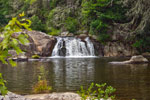
The trails to Linville Gorge Trail (1.4 miles round trip) , and to Plunge Basin (1 mile round trip) also start at the visitor center and are both strenuous. The trail to Linville Gorge forks 0.2 mile from the visitor center. The right fork takes hikers to Plunge Basin Overlook where they can view the lower falls and the Chimneys. The left fork winds down through rock cliffs to the bottom of the falls where the force of the water cascading over the falls creates a large pool. Swimming and climbing on the rocks are prohibited.
History
Fall size:Upper: 45' Lower falls: 150 ft
Beauty Scale:
(1-worth seeing-10 awesome) 9
Linville Falls Community
Access to the Falls can also be obtained from the Kistler Memorial Highway, 105. At the Linville Falls Community, take NC 183 for 1/2 a mile. Turn right on NC 105. Go 1/10 of a mile to the parking lot on the left. The Linville Falls trail is .5 miles long and connects to the Park Service trail system.
Facilities: picnic tables, rest rooms, Campground located nearby.
Visitor Center:There is a visitor contact station in the Linville Falls area via an access road at milepost 316.4. Trail maps, publications and area information are available here. The Visitor Center offers a quaint Blue Ridge Parkway store with gifts, accessories, and information concerning Linville Falls and The Blue Ridge Parkway. Located within the Visitor Center are rest rooms and water fountains for a quick stop before or after the hike. Also found within the Linville Falls Visitor Center is a sizeable map on one of the inside walls. The map details each of the trails in the area: their locations, lengths, destinations, and difficulty.
Linville Falls Campground:The campground has sites for 50 tents and 20 trailers. Facilities include water, flush toilets with sink but no showers or hook-ups.
Other Lodging: Several motels, bed-and-breakfast inns, and campgrounds are located in nearby Linville (exit at milepost 305), Pineola (exit at milepost 312.2), and Linville Falls (exit at milepost 317.5).
Closest town:Brevard North Carolina
Home | Homes For Sale | Farms For Sale | Lakefront Property | Creekfront Properties | Mountain land | Commercial Mountain Real Estate
Our Communities | Working with Advantage Chatuge Realty
Waterfalls of Western North Carolina | Nantahala National Forest | Appalachian hiking trail | Fires Creek wilderness area | Joyce Kilmer Area
Outdoor Recreation in the mountains | Nantahala National Forest | Appalachian hiking trail | Fires Creek wilderness area | Joyce Kilmer Slickrock Wilderness Area
Georgia Waterfalls | Hiking trails of the Georgia Mountains | Georgia State Parks
Hayesville North Carolina | Murphy North Carolina | Hiawassee Ga | Blairsville Ga | Blue Ridge Ga | Young Harris Ga