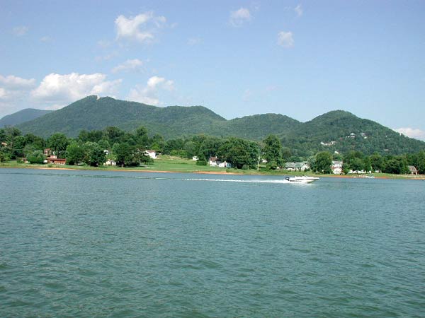
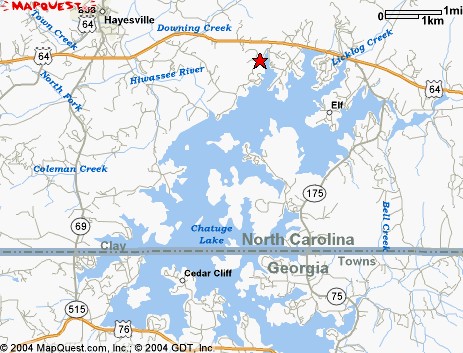
Beautiful Lake Chatuge is nestled
between two states and the two towns of
Hayesville North Carolina and Hiawassee Georgia
In Cherokee legend Tusquitee refers to the
place "where the water dogs laughed." This area, now a part
of the Nantahala National Forest in Clay County, has one of the most
scenic lakes in the Tennessee Valley Authority (TVA) system. The 130
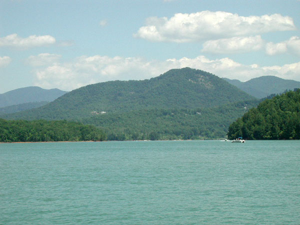
miles of shoreline around Lake Chatuge is magnificently framed by
the nearby Tusquitee Mountains and "the Great Blue Hills of God,"
as the Cherokee called the Blue Ridge Mountains.Visitors enjoy leisurelyy
strolls along the dam with its spectacular view of the lake and surrounding
mountains. The lake has numerous fingerlike projections of land forming
interesting coves for great fishing, swimming, boating, and water
sports.
The Chatuge Dam is 144 feet high, and the
lake supports water sports and recreation. The fishing is good with
more than 32 species in the lake. Jackrabbit
Mountain Recreation Area | s situated on a pine-wooded peninsula
with hiking trails that offer pleasing views of Lake Chatuge. It isn't
just the abundant salamanders who find reason for mirth in this popular
family recreation area. Clay County Recreation Park is also popular
with families.
History of Lake Chatuge
In 1942, the TVA constructed a 2,950
foot earthfill dam across the Hiawassee River, forming Lake Chatuge.
The record in the Towns County Herald
on Thursday, May 29, 1941, states:>
>"The Tennessee Valley Authority,
faced with a serious shortage of electric power for defense industries
in the southeast, has requested $51,000,000 for the construction of
four new dams on the Hiwassee River at the Barnett Bridge in North Carolina
(just over the Towns County, GA, line.) Two of the proposed dams will
be storage dams, while the other two will be power dams. The one affecting
this county most will be a storage dam. Indications point to early start
on the construction of the dam..."
On July 17, 1941, the Senate passed
the TVA bill, paving the way for construction to begin in earnest. "Water
contour lines have been surveyed and the markers show that Hiawassee,
the town so reported as being in danger of complete inundation, will
be able to keep doing business at the same old stand. The land acquisition
men are still working on deeds and titles at the courthouse in Hiawassee.
Orders to go to work on the dam are expected any day."
Construction of the earth-filled
Chatuge Dam across the Hiwassee River about three miles southeast of
Hayesville, NC, began on July 17, 1941. The TVA dams brought badly needed
jobs for local folks in the lingering post-depression years, which was
a definite boost for the local economy. Of course, the folks whose land
lay in the path of the lake were not so happy. Gone forever were the
approximately 3,700 acres in Clay County, NC and 3,500 acres in Towns
County, Georgia. It was the area's richest and best farmland from which
the residents had gleaned their livelihoods. Churches and schools were
interrupted and moved. The January 9, 1942 issue of the Towns County
Herald, stated that "...141 houses had to be moved...about 60 families
have left the county--affected directly or indirectly by the building
of the dam."

Technical Facts of Lake Chatuge
The dam is made up of 21,900 cubic
yards of concrete, and there was 362,466 cubic yards of earth excavation
for the foundation.
Normal maximum pool for Lake Chatuge
flood control holds 7,050 acre feet of water. Lake Chatuge has 1 enclosed
water-cooled generator and a second generator that was added later.
Lake Chatuge is 13 miles long and
has 128 miles of shoreline with 4 miles of island shoreline giving
a total of 132 miles of shoreline.
offering many recreational opportunities including fishing,
canoeing, skiing, and picnicking.
Fishing for four species of bass,
bream and catfish is popular among visitors
Chatuge Dam is 144 feet
high, 2,850 feet long, and 980 feet wide at the base.
The reservoir is operated for many
uses mostly built for power generation and flood control. It is also
beneficial for water quality, aquatic ecology and helps maintain navigation
depth on the TVA ferment dam system.

Activities:
Fishing, swimming, skiing, camping,
boating, hiking.
Facilities:
Clay County Recreation Park:
30 campsites, picnic shelters, ball field,
swimming area, and a boat-launching ramp.
Directions
6.2 miles east from Hayesville
on US 64 (turn right onto NC 175).
Jackrabbit Mountain:
103 camping sites, swimming beach with showers,
hiking trails, picnic areas, and a boat launching ramp.
Fees:
There is a charge for camping.
Closest towns:
Hayesville, North Carolina, approximately 6 miles.
Hiawassee Georgia


