Big Laurel Falls
In a beautiful part of the Nantahala
National Forest near Standing
Indian Campground | s this little
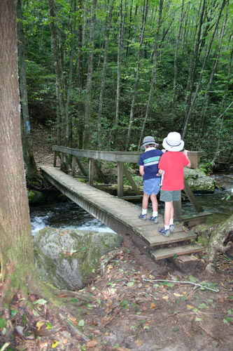
jewel of a waterfall called Big Laurel Falls. A short .6
mile hike that follows the path of an old logging railroad, the
trail meanders along a raging noisy Big Laurel Branch creek with
lots of big boulders. Although most books rate this trail as easy,
I would say due to the root rutted trail it is more on the easy
side of moderate. There are no steep grades on the hike only mild
inclines and descents but the rough trail makes it a cautious hike
in some areas making the half mile distance seem further then it
is. Once there however, you are rewarded with a beautiful falls
and an overall enjoyable hike with unusal trees and lots of rhodadendron
along the way. One warning though, stop to look along the way or
you may stumble on this trail. This one is worth the trip.
Fall size:
Beauty Scale:
(1-worth seeing-10 awesome)
20'
6
Directions: from Fanklin, North Carolina
Head west on Hwy 64 up over the pass toward
Hayesville to West Old Murphy Road a left turn towards Standing Indian
campground. It's a beautiful 7.1 mile drive through the Nantahala
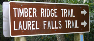
forest to a pull out on the right at the trail head for Big Laurel
Falls. There's a sign there.
Just FYI: At 1.8 miles you will see the entrance
to Standing Indian Campground on your right. At 2.4 miles the road
turns from paved to gravel.
Directions: from Hayesville, North Carolina
Head east on Hwy 64 20.7 miles up the pass
toward Franklin to West Old Murphy Road a left turn towards Standing
Indian campground. It's a beautiful 7.1 mile drive through the Nantahala
forest to a pull out on the right at the trail head for Big Laurel
Falls. There's a sign there.
Just FYI: At 1.8 miles you will see the entrance
to Standing Indian Campground on your right. At 2.4 miles the road
turns from paved to gravel.
Fees:
none
Closest town:
Between Franklin North Carolina and Hayesville
North Carolina
For more information:
Wayah Ranger District
90 Sloan Road
Franklin, NC 28734
828-524-6441
(Turn at sign on U.S. 64, west of Franklin)