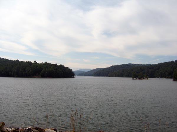
Lake Glenville
Lake Glenville is located 2 miles from downtown Cashiers NC and provides
26 miles of shoreline sitting at an elevation of 3500 feet. The full
recreational lake provides good fishing, boating, skiing and sailing
for the sports enthusiast. If you are looking for beautiful shoreline
property and recreational fun … Lake Glenville is a beautiful lake
to explore.
Located in a Beautiful Mountain Forest Lake Glenville ( Thorpe Reservoir
) is the Gem of the Cashiers-Glenville Area. This pristine clear water
lake boasts of glistening sandy banks for swimming, sun bathing, water
skiing; excellent fishing for small and largemouth Bass, walleye, Trout,
and Bream. A leisurely cruise aboard a pontoon boat to view the three
cascading waterfalls that flow into the lake will begin a love affair
that will last a lifetime.
While filling the new lake, it encompassed the entire valley north
of Cashiers, flooding the town of Glenville and all the schools, homes,
businesses, and farmlands up to a depth of 300 feet.
Lake Glenville is the highest lake east of the mississippi. It has an
elevation of 3,942 feet. There are 26 miles of shoreline, several waterfalls,
and a surface area of over 1500 acres.
The lake is fed by five tributaries and dozens of creeks and streams.
Glenville is a beautiful community rich in history. The original name
was Hamburg Township and was settled in 1827. It suffered during the
Civil War, but was slowly rebuilt, and in the late 1880's was once again
a thriving area with industries such as lumbering, tanning, and mining.
In January of 1891, the town was renamed Glenville. During WWII, in 1940
and 1941, the Nantahala Power and Light Company, then owned by ALCOA
Company, constructed a dam on the Tuckasegee River so it could supply
their company with more electricity to make aluminum for the war effort.
Marine life:
small and largemouth Bass, walleye, Trout, and Bream.
From the junction of Hwy 19 23 and Hwy 28 north take Hwy 19 to the
Nantahala River Launch Site to NC1310. Follow NC1310 to SR308 on right.
Take SR308 to FS67. After you pass the Apple Tree Campground take SR1401
then back onto FS67. Follow signs to boating access area.
Activities:
Swimming, boating, fishing, hiking, camping, picnicking, horseback riding, rock climbing, and golf.
Facilities:
Primitive Camping allowed on public National Forest Lands except where
signed, no camping.
Fees:
Closest Town:
Cashiers
Topton
Franklin is 18 miles
